

Katahdin Woods and Waters National Monument
One thing you can say about the new Katahdin Woods and Waters National Monument. It’s an adventure.
There are few amenities and no services in this wild, 87,500-acre chunk of Maine’s North Woods. If you come, bring your own gas, food and even your own water—or a way to purify the water you find. Cell service? Forget about it. Study up on your compass skills, carry good maps and pack a GPS. Vault toilets—outhouses in park-speak—will become your friends. If you stay overnight, it’ll probably be in a tent or a lean-to. Even driving is a challenge. Most of the roads are dirt.
Maine’s New Monument
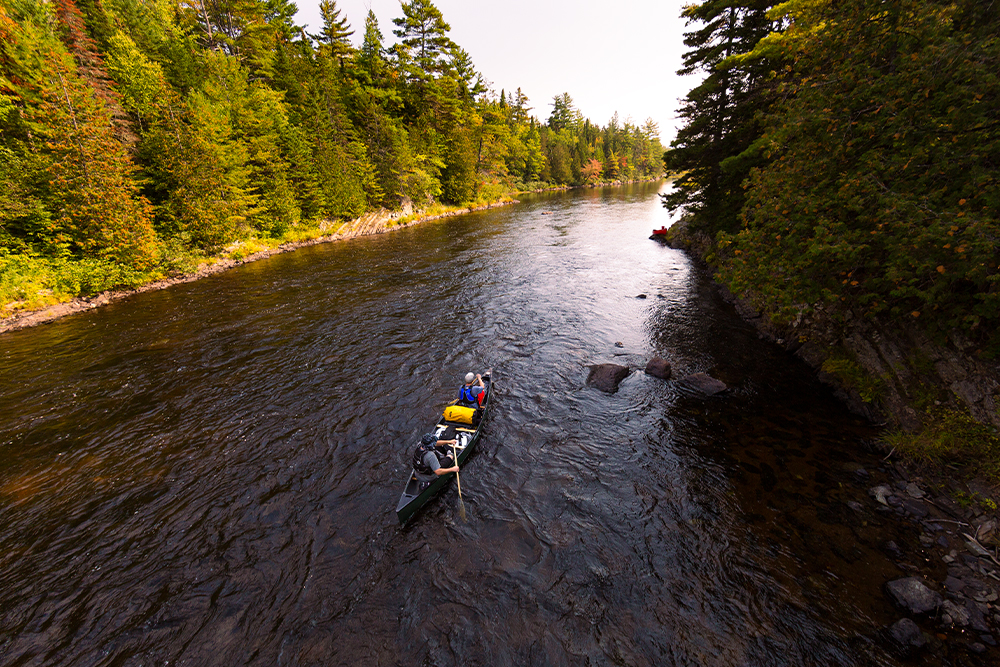
If this intrigues you, the rewards of Katahdin are many. The Monument, just east of Baxter State Park, was created in 2016. So far, an adventurous few have ventured north to enjoy it. Those that have discovered vast swaths of woodlands—some old growth, some newer growth sprouted from more recent logging. The East Branch of Penobscot River, prime trout fishing and canoeing territory, rushes through the Monument, providing great boating and fishing. The same gravel roads that rock and rattle cars are great for mountain bikes.
From approximately mid-May to mid-October, two visitor contact stations are operated in the gateway communities of Patten and Millinocket. Check the Monument website for locations and hours. If stopping in Millinocket, stay awhile and look around. It’s been transformed from a papermaking town into a gateway for the Great North Woods. In Patten, visit the Lumbermen’s Museum, a cool spot to learn about the industry that built much of the area.
Driving To (and inside) The Monument

For a first approach to the Monument, drive down Route 11, also known as the Katahdin Woods and Waters Scenic Byway. This road not only leads to the Monument’s entrances, it’s also a picturesque route through the surrounding landscape.
Once inside the Monument, turn onto the Katahdin Loop Road—and maybe break out your bike. This 17-mile dirt road leads through the heart of Katahdin to trailheads and scenic stops. Check out The Friends of Katahdin Woods and Waters for a tour of the Loop Road.
Great Hikes
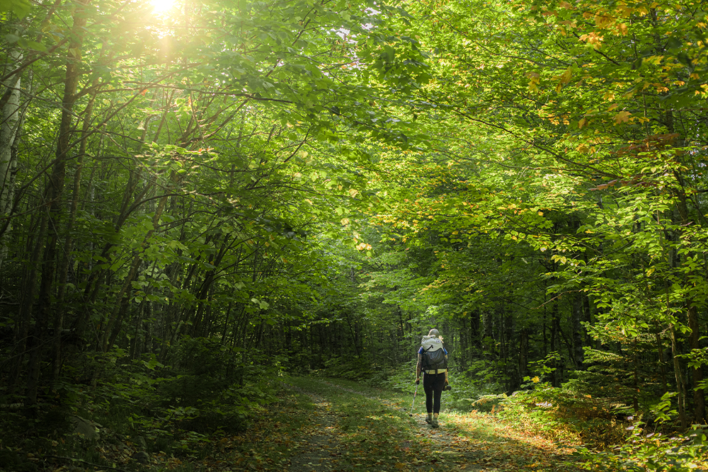
For hikers, the Monument is a developing wonderland, with some existing trails to be enjoyed and new ones being created. Consider:
Barnard Mountain Trail
This short (1,621 foot) peak sits just off the Katahdin Loop road. A great picnic spot with terrific views.
Orin Falls Trail
Much of this hike off the Katahdin Loop road follows an old logging road and takes hikers to Wassataquoik Stream.
Deasey Mountain Trail
This hike includes a walk on an old logging road, fording a stream, a jaunt on the International Appalachian Trail and a steep, brisk climb to the 1,964-foot summit and its historic fire look-out.
International Appalachian Trail
This 30-mile section of the International Appalachian Trail—which continues the AT north into Canada—is remote and can be tough, so experience and planning is needed.
Winter in Katahdin
Come winter, visitors can start at Katahdin’s north entrance and glide down sixteen miles of groomed cross-country ski and snowshoe trails. There’s also access for folks wanting to winter hike, ice fish, fat bike and even winter camp—in tents, lean-tos and in bunks at several huts. Snowmobilers can enjoy 22 miles of groomed trail as well. Check the Monument website for updates, possible closures, etc.
Businesses & Organizations
 Retrieving results.
